Welcome to Frank Brusca's
Facebook   Twitter
Random Page
Dice
   
US 40 Shield
Route40.net
The best source of historic and contemporary information for America's finest transcontinental highway.
If you see a page you like, bookmark it with the social media links below.

Alignment

The Golden Belt

The Golden Belt was a trans-state highway across Kansas. It ran from Kansas City to the Colorado border near Kanorado. Most of Route 40 follows what was the Golden Belt.

Below are detailed sections from a 1918 state road map showing the route of the Golden Belt.

View user comments below.


Details of the Golden Belt from the 1918 state roadmap. Click here for a larger display.


User Comments · Add a Comment

 
Posted by: Roland Miller on Wednesday, January 2, 2019 at 10:39:19 AM

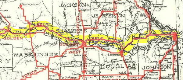
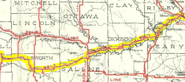
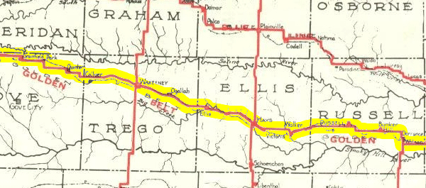
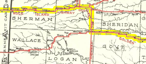
Our property has an abandoned road bed and have been seeking the name of the road. While at coffee today, I visited with 2 individuals who have a long history in Wamego, KS so I asked them about the name of the roadway. Vic said the road was called the Golden Belt Highway and Hwy 40. So, after looking at the info on the data in this web site and comparing it to the info from Vic, an old stone bridge on our property and an old abandoned road way between Wamego, KS and Manhattan, Ks, would suggest the Golden Belt was on the North side of the Kansas River between Wamego and Manhattan instead of crossing the river at Wamego and crossing it again at Manhattan. "Something to think consider"


Feedback: Do you have corrections or contributions for this page? Want to make a suggestion? Click here to send me an e-mail. I am espcially interested in memories, stories, postcards and photographs. Thanks!

Frank

Last updated: 2010-11-29 05:34:30

  Works best with Firefox.


Frank X. Brusca. All rights reserved.


Contact · About · Advertising · Terms · Privacy · Legal
Hosted by 1&1