Jordanelle Reservoir/Ross Creek Valley
Kamas, UT 84036In 1995, the Ross Creek valley was flooded by a large earten dam. Route 40 was rerouted to the west roughly following an old railroad grade.
From the Historic American Buildings Survey:
The Provo River flows from the Uinta Mountains southwesterly toward Utah Lake. On the way, it passes through the Jordanelle Valley eight miles north of Heber City. Anglo settlement in the valley began in the 1860s by Mormon pioneers such as William Davis and William Hailstone. The economy was based on irrigated agriculture and consisted primarily of cultivating hay and alfalfa for livestock. By the early 20th century, several other ranches were in operation, including the Henry Cluff ranch along Drain Tunnel Creek and the John Jordan ranch near Jordanelle Narrows.
In the 1890s the Ontario Mining Company drilled a tunnel to dewater its silver mines. The Park Utah Mining Company later developed the tunnel as Keetley Mine and built structures around its portal. To supply housing for mine workers, George Fisher built the small community of Keetley on U.S. 40 on part of the Cluff Ranch. During WWII Fisher leased his ranch to a colony of Japanese-Americans from Oakland. Little has changed since to alter the historical character of the Jordanelle Valley.
View user comments below.
|
 |
 |
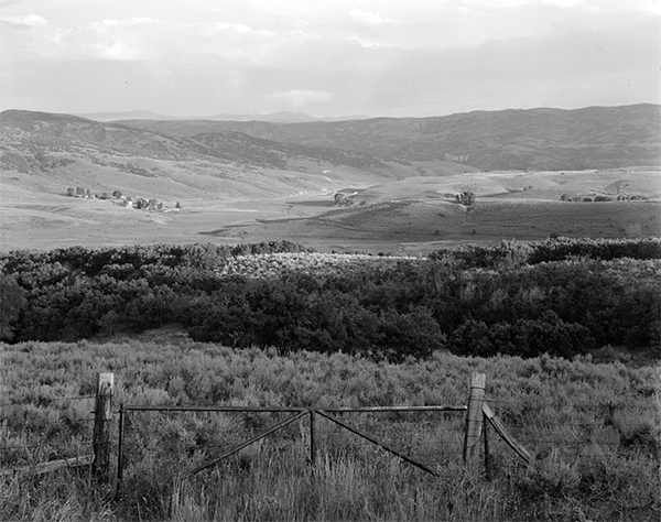
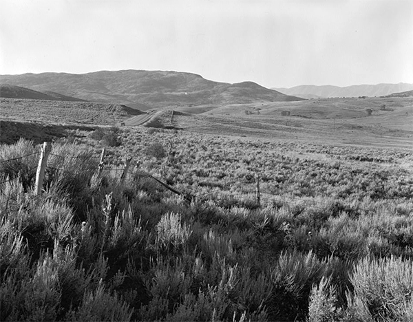
Ross Valley before it was flooded by the Jordanelle Reservoir. Courtesy of the Library of Congress/Historic American Buildings Survey.
|
|
 |
|
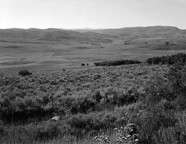
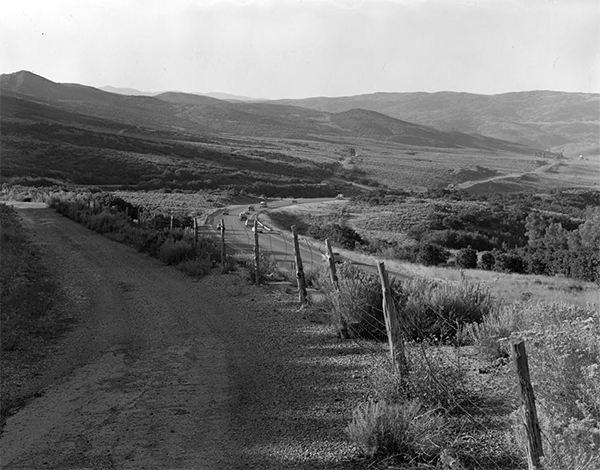
Ross Valley before it was flooded by the Jordanelle Reservoir. Note th eold alignment of Route 40 in the distance. Courtesy of the Library of Congress/Historic American Buildings Survey.
|
|
 |
|
Looking southeast into the Ross Creek valley. There are two alignments of Route 40 visible. The main alignment and the older alignment on the hillside above. Much of this scene (including the Route 40 alignments) are now underwater. Courtesy of the Library of Congress/Historic American Buildings Survey.
|
|
 |
|
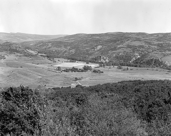
Looking northeast into the Ross Creek valley. Route 40 (barely visible through the trees) runs through the valley. Much of this scene (including the Route 40 alignments) is now underwater. Courtesy of the Library of Congress/Historic American Buildings Survey.
|
|
 |
|
Looking south into the Ross Creek valley. Route 40 can be seen in the road cut at the center left. Much of this scene (including the Route 40 alignment) is now underwater. Courtesy of the Library of Congress/Historic American Buildings Survey.
|
|
 |
|
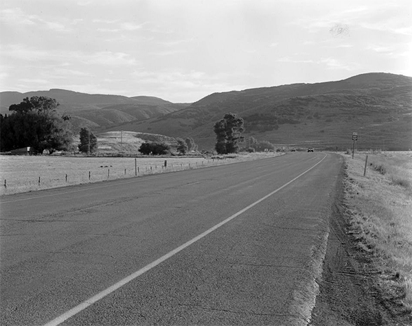
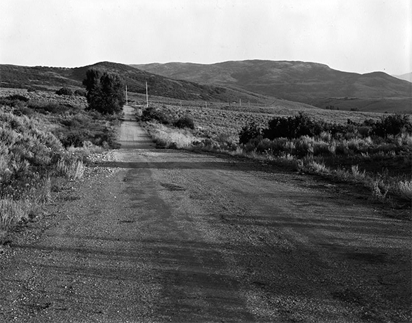
Looking south into the Ross Creek valley. This scene shows two alignments of Route 40. The older is the gravel road to the left. This scene escaped the flooding of the Jordanelle Reservoir. There is a condominum community located here today. Courtesy of the Library of Congress/Historic American Buildings Survey.
|
|
 |
|
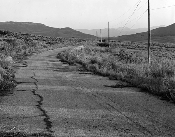
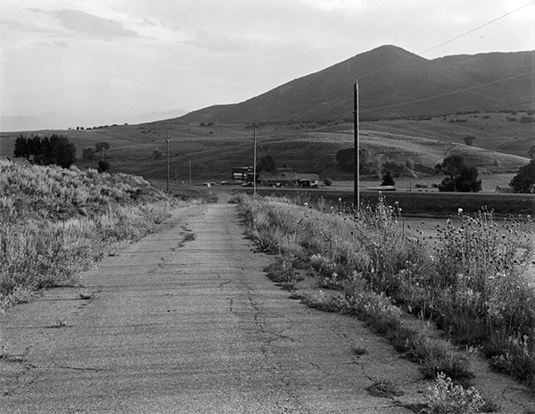
Looking south into the Ross Creek Valley. This scene shows an old alignment of Route 40. This stretch of roadway remains above water, however, much of the scene to the right is below water. Courtesy of the Library of Congress/Historic American Buildings Survey.
|
|
 |
|
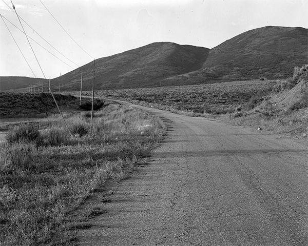
Looking north from the Ross Creek Valley. This scene looks in the opposite direction from the previous photograph. It too is above water. Courtesy of the Library of Congress/Historic American Buildings Survey.
|
|
 |
|
Looking south into the Ross Creek Valley. Another view of the old alignment of Route 40. This scene is above water. Courtesy of the Library of Congress/Historic American Buildings Survey.
|
|
 |
|
Keetley, Utah. An old alignment of Route 40 is in the foreground. This scene is now under water. Courtesy of the Library of Congress/Historic American Buildings Survey.
|
|
 |
|
Jordanelle Reservoir. Courtesy of the Library of Congress/Historic American Buildings Survey. Click here for a larger display.
|
For more information:
No comments have been posted.
Feedback: Do you have corrections or contributions for this page? Want to make a suggestion? Click here to send me an e-mail. I am espcially interested in memories, stories, postcards and photographs. Thanks!

Last updated: 2010-12-23 17:32:16 |