|
Negro Mountain
Grantsville, MD 21536No one knows with any certainty how the mountain was named, however, the most popular tale is that it was named after a slave named Nemisis who died in an Indian fight.
From Searight's The Old Pike (1894):
Onward, westward and upward, the crest of Negro Mountain is reached. There are several versions of the origin of the name of this mountain. Probably the one most worthy of acceptance is that in the early collisions between the whites and the Indians, a negro appeared as an ally of the Indians in a conflict on this mountain, and was among the slain. Negro Mountain is two thousand eight hundred and twenty-five feet above the level of the Atlantic ocean, and the second highest elevation on the line of the road. The old commissioners give the height of the mountain as two thousand three hundred and twenty-eight and twelve one-hundredths feet, from their base of measurement in the Potomac, near Cumberland, and as before stated, make no mention of Keyser's Ridge.
View user comments below.
|
 |
|
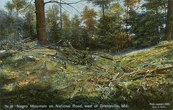
Negro Mountain on National Road, west of Grantsville, Md. 1908 postcard.
|
|
 |
|
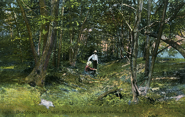
Spiker Run on Negro Mountain. 1908 postcard.
|
For more information:
No comments have been posted.
Feedback: Do you have corrections or contributions for this page? Want to make a suggestion? Click here to send me an e-mail. I am espcially interested in memories, stories, postcards and photographs. Thanks!
Last updated: 2014-02-27 12:53:33 |
|
|

|
|