Cross-Country Route 40 Bike Trip - Day 20: Junction City to Lawrence, Kansas
| Distance: |
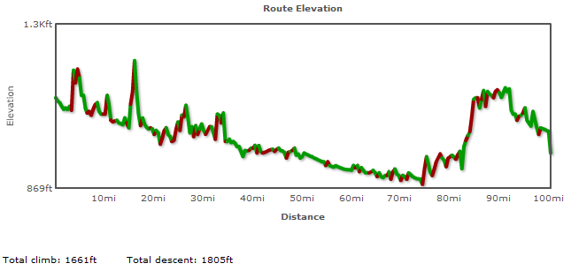
100.9 miles |
| Description: |
The day's journey is mostly downhill with a gradual 250 foot ascent for the last 25 miles. This section follows the ORIGINAL alignment of Route 40 which ran north of the Kansas River. Between St. Mary and Lawrence, you'll essentially be biking along the Oregon Trail. I am not providing an alternate route along the current alignment of Route 40 (which runs south of the Kansas River) because there aren't enough side and frontage roads to make it safe to do so. |
| Details and Map: |
Bikely.com |
|
|
 |
| GIS Data Files: |
Google Earth (KML) | GPX |
Important Notice: Please note that if you elect to follow this itinerary, you do so at your own risk. Failure to exercise good judgment can result in traffic violation citations, injury and even death. I can assume no responsibility for any errors in this information, nor can I be held responsible for anything that may occur while traveling along this route. If you are unsure about the legality of pedestrian travel along any of the roads described here, please consult with state and local law enforcement agencies.
View user comments below.
For more information:
No comments have been posted.
Feedback: Do you have corrections or contributions for this page? Want to make a suggestion? Click here to send me an e-mail. I am espcially interested in memories, stories, postcards and photographs. Thanks!

Last updated: 2009-11-22 08:31:41 |